
Yakima/Klickitat Fisheries Project
Klickitat Subbasin Data
 Information
about the health, abundance, distribution and other data about Klickitat
subbasin fish and their environment is collected by YKFP staff throughout
the subbasin on an ongoing basis. Temperature data is primarily collected
by the Research, Monitoring and Evaluation
program, while management and analysis of the data is performed mainly
by YKFP Data Management and KWEP (Klickitat
Watershed Enhancement Project).
Information
about the health, abundance, distribution and other data about Klickitat
subbasin fish and their environment is collected by YKFP staff throughout
the subbasin on an ongoing basis. Temperature data is primarily collected
by the Research, Monitoring and Evaluation
program, while management and analysis of the data is performed mainly
by YKFP Data Management and KWEP (Klickitat
Watershed Enhancement Project).
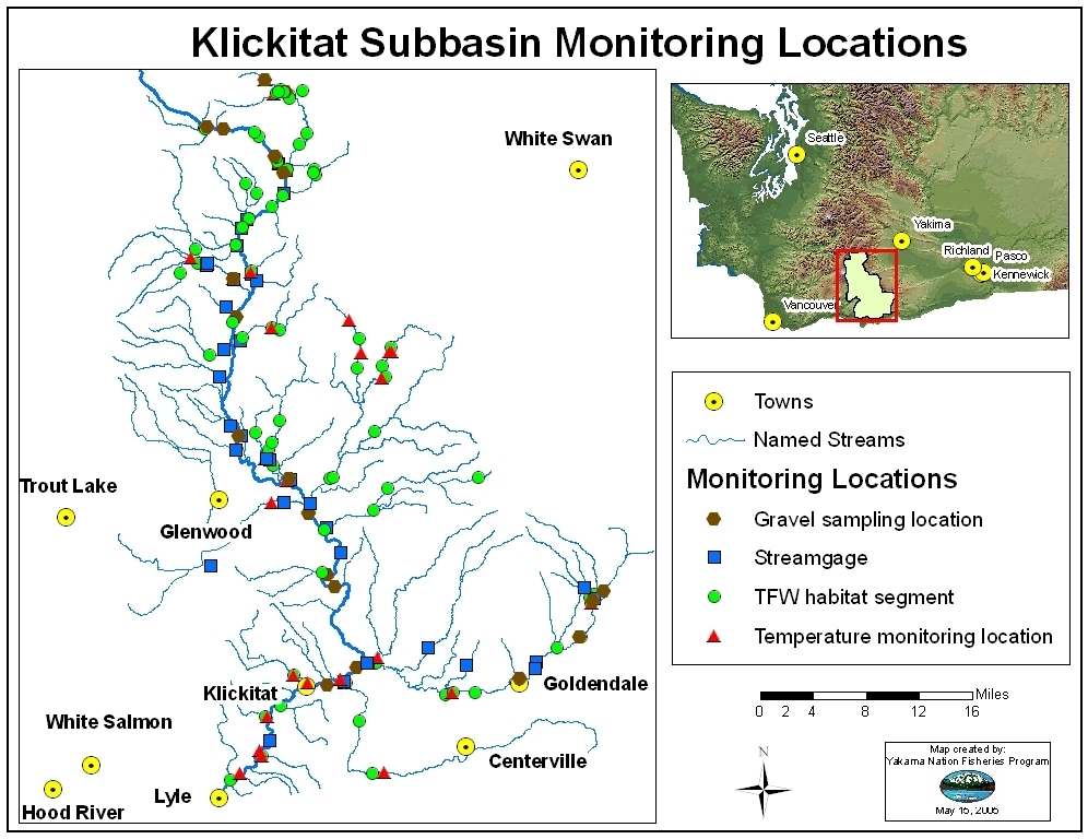
Roll over a location on the interactive map below to view a data report for that monitoring site.
Select from the drop-down menus below to view data reports.
|
Field
Data
|
Artificial
Production Data
|
Metadata
|
|
|
Habitat Data |
Fish data
|
||
USGS real-time water data site for the Klickitat River below Pitt, WA.
Please click on one of the site locations on the map to view data reports for that location.
TEMPERATURE DATA FOR THE LITTLE KLICKITAT RIVER (1996-2007)

Daily and 7-day average temperatures for the Little Klickitat River (1996-2005).

Data collected, compiled and provided by YN Fisheries
Contact Information:
Telephone: 509-369-3270 | FAX: 509-369-3194 | Postal address: P.O. Box 251, 1575 Horseshoe Bend Rd., Klickitat, WA 98628
E-mail:
General Information: info@ykfp.org
Send e-mail to webmaster@ykfp.org
with questions or comments about this web site. Last modified: 10/06/06